
The map below provides an overview of the locations of 41 recognised birding sites in Northamptonshire. This is followed by a further 20 maps, which detail the county’s most popular sites and those which feature most frequently on the Latest Reports page.
![]() In the overview map, click a number to identify the location, followed by
In the overview map, click a number to identify the location, followed by ![]() to close the information box or click
to close the information box or click ![]() for a drop-down list of locations or
for a drop-down list of locations or ![]() to view a larger version of the map. Click a location name followed by
to view a larger version of the map. Click a location name followed by ![]() to isolate it and
to isolate it and ![]() to return to the full location list. This instruction applies also when viewing areas within each site (see legend of icons, to the left). Clicking on any icon on any map may also bring up one or more photos of the site, or respective parts of the site, plus a short description in instances where these have been added. It is also possible to alternate the map views between schematic and satellite, the latter more accurately portraying geographical features than the former, which is more detailed in terms of routes and road names. Simply click on the square in the bottom left corner of the site or area list.
to return to the full location list. This instruction applies also when viewing areas within each site (see legend of icons, to the left). Clicking on any icon on any map may also bring up one or more photos of the site, or respective parts of the site, plus a short description in instances where these have been added. It is also possible to alternate the map views between schematic and satellite, the latter more accurately portraying geographical features than the former, which is more detailed in terms of routes and road names. Simply click on the square in the bottom left corner of the site or area list.
Jump to:
![]()

![]()
![]()
![]()
![]()
![]()

![]()
![]()
![]()

![]()
![]()
![]()

![]()
![]()
![]()
![]()

Also known as Northampton Washlands and the Nene Barrage, this is an SSSI which, as a result of its suburban location, is subjected to considerable human disturbance. Despite this, it holds a number of wetland breeding species, it is important for wintering wildfowl and it continues to produce interesting species, including passage waders and terns during spring and autumn. There is free public access to the Main Barrage Lake but the other lakes are private, though largely still viewable.
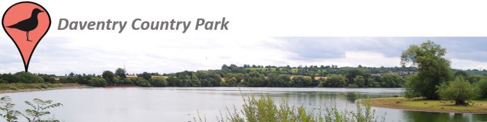
Daventry Country Park is a suburban location, receiving many recreational visitors, which are shielded from the main body of water by vegetation along all parts of the perimeter track, excluding the dam. Disturbance is minimal as a result and the site has produced some outstanding birds over the years. Access to the site is free.

The third phase in the continuing expansion of Daventry International Rail Freight Terminal (DIRFT 3), to cover an area bounded by the M1, A5 and Hillmorton Lane (Lilbourne), has produced an area of land which is in a constant state of flux. Alongside the continuing Prologis building construction, the site comprises areas of scrub and mud, which is prone to flooding. Still in development, Lilbourne Meadows is a new nature reserve resulting from the partnership between the Wildlife Trust BCN and Prologis. The reserve was scheduled to open fully in 2022, and was designed as an ecological mitigation zone as part of the DIRFT expansion, on its northern flank. Although still closed (January 2023), when complete, this new nature reserve will provide a huge mixed habitat of wetland and grassland with extensive hedgerows.

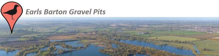
An extensive area of lakes and pits bordered by Wellingborough in the west and the A6 at the eastern end. It also encompasses Wilson’s Pits LNR and Irthlingborough Lakes and Meadows LNR (see separate map), the latter having recently undergone extensive reprofiling to provide habitat for waders. The east-central part of the complex is likely to suffer from considerable human disturbance as a result of the integrated large shopping complex completed in 2017. Despite this, there is a significant amount of as yet undisturbed habitat at the western end.
An established area of old mature pits, reeds and marshland, encompassing Summer Leys LNR (see separate map) lying between Whiston in the west and Irchester in the east. It also includes Grendon Lakes fishing and watersports. There is a working gravel extraction site at the western extremity and an extensive area of Phragmites with a reed-fringed pool, known as Quarry Walk, south of the main Hanson processing site.

One of the oldest birding locations in Northamptonshire, Ecton Sewage Farm dates back to pre-1940. Processed sewage was pumped out to drain over a wide area of land, creating a perfect habitat for wildfowl and especially waders. Currently, the same fields hold remnants of the old sewage beds, especially at the eastern end, which periodically floods, creating favourable habitat reminiscent of the conditions which prevailed in the late 20th Century. The adjacent Billing Gravel Pits were excavated in the late 1960s/early 1970s and, through succession, have become largely overgrown and have been given over to angling.

Designed by Capability Brown, the landscape gardener, who transformed the park in the 1760s by damming one of the lakes and creating sweeping vistas, planting trees and laying lawns. Most of the park is permanent pasture with mature parkland trees.

An area of high ground comprising arable farming, scrub and a small area of woodland on its northern periphery. Attracts passerine migrants in both spring and autumn as well as raptors during the winter. Public access primarily along the concrete track.
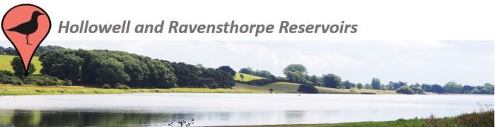
Two relatively small reservoirs in close proximity to each other. Both hold reasonable numbers of wintering wildfowl. Hollowell is usually the first of the Northamptonshire reservoirs at which the water level begins to drop from late summer, consequently proving attractive to passage waders. Ravensthorpe is free to access but entry to Hollowell is by permit only, available from the Fishing Lodge at Pitsford Reservoir.

One of the more recently created reserves and part of the Ditchford Gravel Pits complex, comprising river valley flood pools and old gravel pits, some which have been reprofiled to attract waders. Access to the area is easy and largely unrestricted, although the meadows at the eastern end are off limits.

One of the less frequently visited reservoirs from a birding perspective, Naseby is popular with anglers and is also one of the first to experience a significant drop in water level in early autumn, as a result of its supplying water to top up local canals. The exposed areas of mud have, therefore, proven attractive to passage waders and other littoral species.

Also known as Pitsford Water. A veteran locality, historically the most popular birding location in Northamptonshire but now surprisingly underwatched, despite having a series of excellent hides around the section north of the causeway, which is a Wildlife Trust-managed nature reserve. Access to the reserve is by permit only – free to Wildlife Trust members on application but day permits are available to non-members from the Fishing Lodge. There is free public access to all areas of the reservoir between the causeway and the dam.

A long-established landfill site with a recycling centre, situated between Kettering and Corby, close to the A6003. The site’s principal attraction is gulls, with up to 4,000 having been counted in recent winters. There is no public access to the landfill but gulls also gather in surrounding fields and there are opportunities for viewing from roads on the south, east and western periphery.
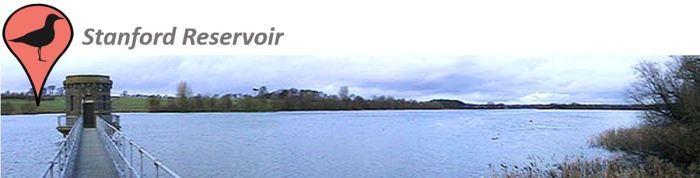
This locality shares a common border with Leicestershire, although the majority of the site is within Northants. It attracts many wintering wildfowl but the water level rarely drops significantly enough to attract waders but, when it has fallen, it has proven to be exceptional. A permit, available from Severn Trent Water, is required to access the site.
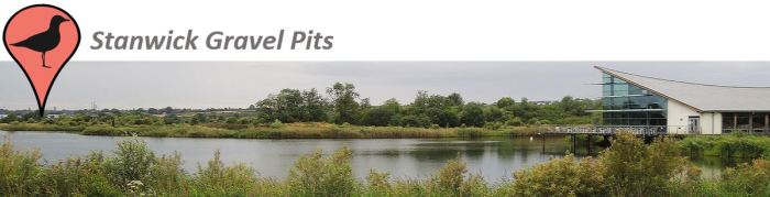
Also known as Stanwick Lakes, this site attracts many migrants which use the Nene Valley Flyway. It houses a large Black-headed Gull colony in summer and is one of the best sites in the county to see pre-roost gatherings of large gulls. A Visitor Centre with a barrier-operated Pay & Display car park and various recreational facilities with unrestricted public access attracts a wide variety of users.

A truly urban location with numerous access points, this site dates back to the 1960s and the northern lakes are currently a local nature reserve, run by the Wildlife Trust for Bedfordshire, Cambridgeshire and Northamptonshire. The reedbed is one of the largest areas of Phragmites in the county.
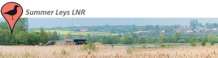
Part of the original Earls Barton Gravel Pits complex, Summer Leys is a Wildlife Trust-managed local nature reserve which provides an important breeding habitat for wetland species, including Black-headed Gull, Common Tern and waders. Spring and early summer are the most productive times to visit, wildfowl proliferate in winter, while autumn has consistently proved to be the quietest time of the year, birdwise. Open public access attracts a wide variety of users.

Thrapston Gravel Pits is a long-established complex of flooded aggregate excavations located in the Nene Valley in north-east Northamptonshire. The largest body of water, Town Lake at the southern end, houses a sailing club while the small Titchmarsh Local Nature Reserve, near the northern end, is managed for wildlife. There is largely unrestricted public access but it remains relatively quiet and the area is underwatched.
